|
Today in New Orleans History |
|
|
January 17


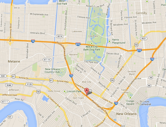
 At this interchange,
I-10 breaks off to the northeast and Business U.S. 90 begins. The expressway continues southeast along the upriver side
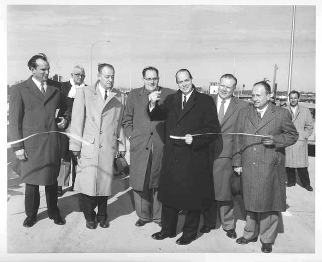
of the CBD as an elevated highway that leads to the Crescent City Connection. This section was completed by 1958 opening of
the Crescent City Connection. The Business District U.S. 90 portion of the expressway
was expanded in the mid 1980s to accommodate the second span of the Crescent City Connection which opened in 1988. This
stretch of the expressway and the stack interchange of I-10 and U.S. 90 received further reconstruction in the early 1990s,
including two reversible HOV (High Occupacy Vehicle) lanes that stretch from the intersection of Earhart Boulevard and Magnolia
Street (underneath the Pontchartrain Expressway) across the Crescent City Connection to the Westbank Expressway. Reconstruction of the northern end of the expressway in the I-610 Split vicinity was undertaken in the late 1990s.
Also in the late 1990s, further work was done on the expressway as three ramps were constructed, one connecting East Business
U.S. 90 to East I-10 and the others connecting West I-10 to West Business U.S. 90 and westbound Claiborne Avenue (West US
90). The Norfolk Southern Railway has an overpass crossing near the Metairie Cemetery between the
City Park Avenue and West End Boulevard/Florida Avenue exits. Here the expressway dips down to 12 feet below sea level to
allow for the rail line to pass overhead. This area once experienced flooding on a regular basis in heavy thunderstorms
and tropical systems. The problem was so common, a depth meter was painted on the overpass support columns to warn drivers
of the water's depth. A new pumping station was completed adjacent to the expressway in 2004 to keep this area dry and allow
the interstate to remain open in the event of an evacuation. In the aftermath of Hurricane Katrina, this pumping station was overwhelmed and
the railroad underpass and the entire I-610/West End Boulevard interchange was extensively flooded. In fact, the 17th Street
Canal breach is about one mile north of this area. This flooding cut Orleans Parish off from most areas to the west, making
the Crescent City Connection one of the few clear routes into the eastbank of Orleans Parish. Areas under the elevated portions
of the expressway in the CBD area saw flooding in the vicinity of the Superdome but for the most part remained dry and undamaged.
Some evacuaees trapped in the city for days after Katrina attempted to use the expressway and the Crescent City Connection
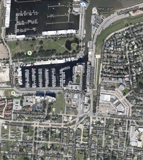
to walk to dry ground on the West Bank. Source: http://en.wikipedia.org/wiki/Pontchartrain_Expressway All that remains of the New Basin Canal, which was used for much of the route of the Pontchartrain Expressway, is
a short stretch at the lake between the Southern Yacht Club and the New Canal Lighthouse which runs south to Lake Marina Drive
(viewed on the left). St. John the Baptist parochial school at the corner of Dryades and Calliope
Streets was demolished to make way for the elevated Pontchartrain Expressway.  
To receive an update for each day in New Orleans
history, join our facebook page
- Today in New Orleans History
Photos of NOPL's Black History Month and Martin Luther King Holiday Celebration on January 17, 2008. Photos of the New Orleans Public Library's celebration of Dr. Martin Luther King Jr.'s birthday and annual kickoff to Black History Month, at the Main Library on January 17, 2002. Local entertainment writer Charles P. Jones, in a January 17, 1937 article, briefly
reviewed "Jungle Princess" (starring New Orleans born Lamour and Ray Milland) which was playing at the Tudor Theater.
"Miss Lamour is given a chance to sing as well as act, and the picture is certain to make its heroine an impressive movie
figure", he wrote. And so it was. Not to mention that Dottie's "impressive figure" was wrapped
in a sarong.
On January 17, 1783 Governor Don Bernardo De Galvez happily informed the Cabildo of the birth of a son.
|
|
|


To receive an update for each day in New Orleans history,
join our facebook page - Today in New
Orleans History.
Analytics |