|
1832 This source says that construction of the New Basin Canal was in 1832
The New Basin Canal, was built by
Irish immigrants. The arduous task of digging the canal through alligator and snake-infested swamps began in 1832. In that
same year, a cholera epidemic hit the city and 6,000 people died in 20 days, many of whom were Irish. When the canal opened
for traffic in 1838, there were 8,000 Irish laborers who would never see their homes again, having succumbed to cholera and
yellow fever. It was the worst single disaster to befall the Irish in their entire history in New Orleans. Ironically, the
New Orleans canal and banking company which owned and built the canal was founded by the aforementioned Maunsel White, and
another Irish-born gentleman, Charles Byrne, was a major shareholder. Financially, the canal was a success as it opened up
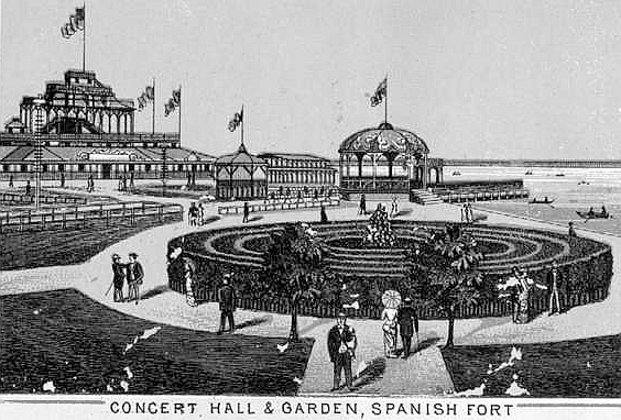
trade with communities north of Lake Pontchartrain and the cities of Biloxi, Mobile, and Pensacola on the Gulf of Mexico.
As the city spread north, finally reaching the lake, its usefulness began to decline. A fund was established to erect a monument
to the thousands of Irish who lost their lives building it. Source: http://www.google.com/search?q=cache:AcgX7Jc0_DI:migration.ucc.ie/euromodule/documents/Irish%2520in%2520New%2520Orleans.txt+%22pontchartrain+railroad%22&hl=en
posted 2002-03-23

1831-1838: The New Basin Canal is built using Irish immigrant labor, claiming the lives of many men who work on
its construction. The canal serves as a transport route between downtown New Orleans and Lake Pontchartrain. Pleasure seekers
take a mule-drawn barge, complete with musical entertainment, along the New Basin Canal to the resort at New Lake End (now
known as West End).
|
 |
Bayou St. John was fundamental to the early life of New Orleans. In 1803 a canal was dredged from the Bayou toward the
City's heart. This new canal terminated at current day Basin Street named for the ship turning basin at the terminus of the
canal. This canal was originally called the Carondelet Canal in honor of the Spanish governor of that name. In 1838, a new
canal under American control was dredged from Lake Pontchartrain into the City. The new canal was known as the New Basin Canal.
The Carondelet Canal became known as the Old Basin Canal and remained primarily under the control of the Creoles. Bayou St.
John and the Old Basin Canal became commercially less important. The Bayou has not been navigable for the better part of this
century. Construction of vehicular bridges and changes in commerce during this century have rendered the Bayou unsuitable
for water traffic except for very small canoes and skiffs.
Bayou St. John is in the judgement of many geoligist, believed to be the result of a geological fault or fracture in
the ground surface since it is bankless. When the French arrived in Louisiana, Bayou St. John was connected to Bayou Sauvage
and Bayou Metairie. Some beleive that Bayou Metairie and Bayou Gentilly-Sauvage flowed as one stream originally. These connections
do not exist today. The Bayous have not been connected to the Mississippi River in modern times due to natural geologic evolution.
Also, Bayou St. John is no longer directly connected to Lake Pontchartrain. A manmade control structure existed just south
of what is now Robert E. Lee Boulevard until 1960. At that time, Robert E. Lee Boulevard was constructed and a new 'water
fall' control structure was constructed just north of the roadway. This structure regulated the flow of water from Lake Pontchartrain
into the Bayou. This flow was necessary to maintain the ecosystem. The Bayou is not tidal today. The Bayou has a length of
less than 5 miles, an average width of 200 feet, and a maximum depth of 9 feet.

|
|
|
|
The Port Pontchartrain Lighthouse, originally an octagonal wood structure, was erected in 1838 near
the terminus of the Pontchartrain Railroad in
the resort town of Milneburg. Rebuilt as a brick tower in 1855, the structure
was damaged during the Civil War but repaired and relighted in 1863.
In 1929, the lighthouse was deemed obsolete
and was disconnected and donated to the Orleans Levee Board. Before the Levee Board filled in and extended the shoreline,
the lighthouse was 3,000 feet offshore.
|
|
|
|
|
|
The New Basin Canal, was built by Irish immigrants. The arduous task of digging the canal through alligator and
snake-infested
swamps began in 1832. In that same year, a cholera epidemic
hit the city and 6,000 people died in 20 days, many of whom
were Irish.
When the canal opened for traffic in 1838, there were 8,000 Irish laborers
who would never see their
homes again, having succumbed to cholera and
yellow fever. It was the worst single disaster to befall the Irish in their
entire history in New Orleans.
Ironically, the New Orleans canal and banking company which owned and built
the canal was founded by the aforementioned Maunsel White, and another
Irish-born gentleman, Charles Byrne, was
a major shareholder. Financially,
the canal was a success as it opened up trade with communities north of
Lake
Pontchartrain and the cities of Biloxi, Mobile, and Pensacola on the
Gulf of Mexico. As the city spread north, finally
reaching the lake, its
usefulness began to decline. A fund was established to erect a
monument to the thousands
of Irish who lost their lives building it.
Source:http://www.ucc.ie/euromodule/documents/Irish%2520in%2520New%2520Orleans
|
|